Whakapapa
Mount Ruapehu · Manawatū-Whanganui · New Zealand · 1,569 m
- ✕ Temporarily closed
- 60 cm snow depth
- 0/57 runs
- 1/10 lifts
Season runs from 30 May 2026 to 25 Oct 2026
Avalanche danger
Wind slabs will form above 1800 metres elevation over the next 24 hours. Any new snow will be transported to south aspects today, with loading occurring on north aspects tomorrow. The winds shift direction overnight, tending south, with reverse loading likely. The locations of these deposits will be near sheltering terrain features, such as rocky outcrops along ridgelines that act as catchments. At the lower elevations, the new snow is likely to be wet, increasing bonding properties. Wind slab failure on steep, unsupported slopes, likely above 2300 metres elevation.
Area: Tongariro · Full bulletin →
Official bulletin (NZ Avalanche Advisory). Always read the full bulletin before going off-piste.
Where to stay near Whakapapa
Hotels and apartments close to the slopes, with prices and availability for your dates.
- Within 15 km of the resort
- Real prices for your dates
- Many with free cancellation
Affiliate link: if you book, we earn a commission at no cost to you.
What to do without snow
The resort is closed: here is what you can do in the area today.
This is not the resort's official programme: it is what is mapped in OpenStreetMap within 5 km of the resort centre. Check opening times on the resort's own website.
Trail map
Snow seen from space
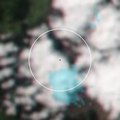
20 %of the ground snow-covered within 7 km · 12 Oct
Last 60 days
% clouds
Source: NASA GIBS, MODIS Terra and Aqua (snow cover) and VIIRS NOAA-20 (true colour). Updated daily with a one-day lag.
Weather by elevation
Whakapapa
1,569 m- Wind
- 20 km/h (gust 63)
- Humidity
- 84%
Snow depth by area
- Summit60 cm
- Base51 cm
7-day forecast
| Day | Weather | Min/Max | Snow | Prob. | Gust |
|---|---|---|---|---|---|
| Fri 16 | Light snow | -3° / 1° | 3 cm | 100% | 108 km/h |
| Sat 17 | Light snow | -3° / 3° | — | 100% | 102 km/h |
| Sun 18 | Clear | 0° / 11° | — | 0% | 86 km/h |
| Mon 19 | Overcast | 4° / 14° | — | 0% | 30 km/h |
| Tue 20 | Overcast | 4° / 13° | — | 4% | 30 km/h |
| Wed 21 | Fog | 2° / 12° | — | 28% | 42 km/h |
| Thu 22 | Overcast | 2° / 10° | — | 39% | 56 km/h |
Live webcams
- Whakapapa - Te Heuheu
- Whakapapa - The Pinnacles
- Whakapapa - The Staircase Slopes
The last 24 hours on camera
 Thu 21:00
Whakapapa - Te Heuheu. One photo per hour from the main camera. Resort time.
Terrain by difficulty
Terrain by difficulty
0 of 57 open- Beginner0 / 13%
- Intermediate0 / 1950%
- Advanced0 / 1642%
- Expert0 / 215%
Skiable area: 550 haSnowparks: 1Half-pipes: 1
Snow report from OnTheSnow · compiles the report published by each resort
Frequently asked questions about Whakapapa
- Is Whakapapa open today?
- According to the latest report (16 Oct, 06:20), Whakapapa is temporarily closed.
- How much snow is there at Whakapapa?
- The snow depth is 51–60 cm.
- What can you do at Whakapapa without snow?
- There are 33 mapped activities around the resort: mountain huts (16), peaks (8), hiking (4). See what to do without snow →
- How often is this information updated?
- The report is read automatically from OnTheSnow every few minutes. The last reading was 9 min ago.
Updated 9 min ago